Nowadays, wildfires are usually detected once they are quite big, and consequently, it is more complicated and takes longer to extinguish them. Moreover, as the wildfires expand, more resources are required for their extinction.
Using satellite images, Galifire – the Galileo Masters Basque Challenge winner 2018 – will provide the opportunity to detect wildfires in their early stages. And, by combining this with Galileo positioning, it will be possible to extinguish them faster than ever.
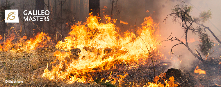
The smoke generated in wildfires is formed by several gases, tar, coal, water vapour and ash. These components contribute to the pollution of the air in the lower levels of the atmosphere, increasing overall Earth pollution to a greater degree than is thought.
Wildfires also burn down trees, which are essential for producing the oxygen we breathe. They destroy ecosystems that are unique in certain areas. They leave people homeless because their houses have been calcinated.
In Spain every year, there are many wildfires during the summer due to the high temperatures and the dry land. In fact, in October 2017, there was a huge wildfire in Galicia, a region in the north of Spain. Almost 50,000 hectares were burned and 4 people died. This fire became so big because of its late detection and the lack of information for the firefighters regarding the situation of the fire.
Galileo Masters Basque Challenge winner 2018
This is when we wanted to come up with an idea to help to handle wildfires. Then, with the purpose of making the world greener, we decided to create a working system that helps to extinguish wildfires as soon as possible using the Galileo satellite system. We called it Galifire, “Gali” from Galicia and Galileo and “fire” due to its aim of putting an end to big wildfires.
In order to design and develop a novel and innovative system to suppress wildfires before they spread, it is first essential to understand and analyse the work that other researchers have done in the field so far. One of the principal goals of Galifire is to combine Galileo and some other existing technologies to localise the starting point or the focal point of fires in the forest and let the emergency services, mainly the firefighters, reach the area in danger as quickly and safely as possible.
Nowadays, the system designed to capture, store, manipulate, analyse, manage, and present spatial or geographic data is the GIS or Geographic Information System. A wide variety of methods are used to enter data into a GIS, where it is stored in a digital format to be processed later to identify objects, surfaces and slopes on Earth. The most important sources and tools of spatial data acquisition and treatment are satellite remote sensing and geospatial intelligence based on a GIS spatial analysis. GIS implementation is developing very quickly and, since it is usually custom-designed for applications with different purposes, it can easily be integrated into other powerful systems such as GNSS.
Earth temperature measurements
It is interesting to know how Earth’s temperature can be measured. IR or infrared satellite imagery is a kind of temperature map that displays objects such as clouds, water or land surfaces (coloured with darker or lighter shades) based on their temperature. Its main advantage is that it relies on heat energy emitted in the infrared spectrum, so it is not dependent on sunlight and can be used outside of daylight hours.
Data is captured not only in the IR band but also in 36 spectral bands in wavelengths from 0.4 µm to 14.4 µm by means of the Moderate Resolution Imaging Spectroradiometer (MODIS). It is a scientific instrument that was launched into Earth’s orbit by two NASA satellites in 1999 and 2002. Its current applications include the monitoring of vegetation health and deforestation rates, snow cover trends, changes in water levels, and the detection and mapping of wildland fires. In concrete terms, the United States Forest Service’s Remote Sensing Applications Center continuously analyses MODIS imagery to facilitate the management and extinction of wildfires.
Related to the latter application, there is a Satellite-Based Real Time Wildfire Detection System, called ETRIPS INCENDIOS. The system controls the temperature of the ground and, if it detects an abrupt change (30 or 40 degrees within a short time), it immediately switches to the political map to locate it. Afterwards, it goes to the physical map to check whether the affected area is greater than 20m2. If this condition is met, the system contacts the fire extinction services.
A more and more common use of GNSS, and specifically GPS, in connection with other technologies (mobile telephone GSM, GPRS, UMTS) is fleet management in all types of transport. Vehicle fleet management and tracking systems offer a wide variety of advantages, such as presenting the actual position of moving objects against the background of a digital map, increasing effectiveness in using vehicles, shortening the realisation time for an order, and increasing the punctuality of the provided services.
Finally, there are some other applications of GNSS that might not seem useful when it comes to detecting and suppressing wildfires. However, it is worth mentioning the use of the Global Navigation Satellite System for skydiving. Most commercial drop zones use GNSS to help the pilot “spot” the plane into the correct position that will allow the skydivers to fly their canopies back to the landing area. The calculated perfect location for the drop (called “GPS spot”) takes into account the winds and clouds that the aeroplane passes through. It can therefore be the exclusive visual indicator when spotting in overcast conditions.
Galfire development
We took these existing developments and designed Galifire. This will be a unified system that will combine different technologies and software.
There will be a Galifire operation headquarters, where the satellite images will be captured and processed. This will make it possible to detect any wildfire and its main focal points. After identifying where the fire is, an alarm will be sent to the firefighters in that particular region.
At the same time, there is going to be a Galifire application that will be implemented into the Galileo receivers on fire engines and on the hydroplane system. The application will feature an option to choose in what type of platform it has been installed. There is also software that will be used in the main fire station in each region as a user interface.
In the case of Galileo receivers in fire engines, they will perform positioning on the map thanks to Galileo satellites and will constantly be sending their position to the main station. This means that, if a fire starts, the Galifire headquarters will process all of the fire engine positions and will use the receiver screen to send them the shortest and best path to reach the fire as quickly as possible.
The hydroplane, thanks to the Galileo satellites, is going to be positioned all the time, too. In this case, the position of the strongest spots of the wildfire will be transferred to the application and the point and moment of launching the water will be automated and monitored. This will make the water drop more effective.
Finally, the Galifire software in the fire station in each region will allow all of the things that are happening in the region to be displayed on screens. This means they will be aware of what is going on in real time, and they will have all the information they need to better operate and coordinate the extinguishing of the fire.
To conclude the explanation of the idea, it has to be said that, thanks to Galifire, the focal point of the wildfire will be detected via Modis (GIS) using information such as Earth’s surface temperature from spatial images. Then, Galileo will be used to calculate the specific coordinates to launch the water from the tanks of the hydroplanes, which will improve and automate how the process is currently undertaken. The position of the emergency vehicles will also be determined using Galileo, too. In this way, the whole fleet will be tracked and located, making the service management very efficient. Moreover, this system will take into account the areas surrounding the wildfire in order to calculate the best routes to reach the fire in the safest possible way.
Using Galifire will lead to a reduction in the cost of material and human resources used to extinguish wildfires. Nature will also be spared from the flames, as well as houses on farms situated in the mountains, where the fires are usually located.
Galfire market approach and the team behind it
The team behind Galfire were telecommunication engineer students when they developed the idea. Galifire has two possible potential target markets: Regional or state governments and/or public or private firefighting emergency services.
It is well known that the different countries of the world have varied ways of managing and coordinating their emergency resources and services. So, depending on the country, the potential client could be the government, whether state or regional, or a firefighting services organisation, whether public or private.
Considering that Galifire provides a continuous service that needs constant supervision with both human and material resources, it is not just a product that can be sold directly to a client without any monitoring. This means that Galifire products and services cannot be bought as a simple product.
The exploitation strategy of this project involves charging an initial fee for the general installation and implantation of Galifire (communication devices, software installation, etc.) followed by continuous smaller fees for service and technical support.
If we were to highlight something about Galifire from a technical point of view, it would be that it is a really innovative system that is not only based on Galileo, the satellite system that still has lot to give, but also unifies it with MODIS, opening up a whole new use.
The functionality and advantages of Galifire are that it is a unique system, as there is no firefighting service in the world that works with this kind of detection and management system. New technologies will help firefighters to put out fires more quickly, efficiently and reliably.
We consider ourselves to be a remarkable team. Not only because we are all young engineers and our idea aims to make the world a bit better but also because we are all women. Saying this, we would like to encourage more women to participate in competitions such as the Galileo Masters.
About Marta Urquizu:
 Marta Urquizu is a MSc. Telecommunication Engineer by Tecnun – Universidad de Navarra (Spain), as the other team members of Galifire, Lucia, Miren, Fátima and María. After doing her master thesis in the Center for Arrhythmia Research at the University of Michigan (USA) she started working as Product Developer in a spanish startup of the digital health sector. Marta is responsible for fulfilling the regulatory requirements and the customer expectations. She works together with the technical team in the design and development of product functionalities for the health sector.


