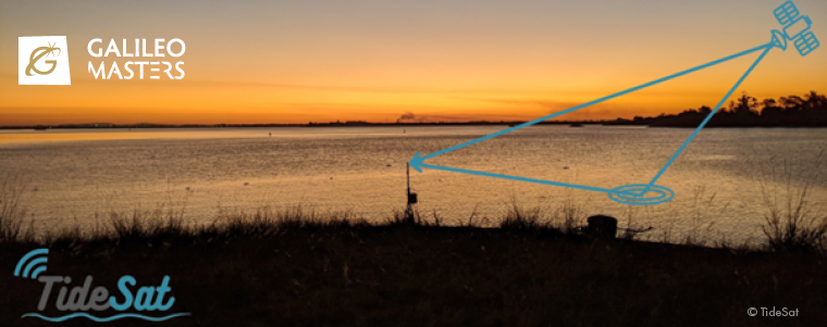
TideSat uses navigation satellites to measure water levels in rivers, lakes, dams and in the ocean. The TideSat sensors can be deployed away from the water surface, at locations more protected from storm surges as well as from theft and vandalism. We are developing a complete Internet-of-Things solution for water level monitoring based on our innovative remote sensing technology. It transfers raw GNSS data to the cloud, where water levels are retrieved and made available to end users and partner integrators. Our solution will contribute to the safety of countless coastal and riverine communities exposed to climate change and extreme weather events. We seek to promote wider access to water level data, popularizing this type of measurement among under-served regions.
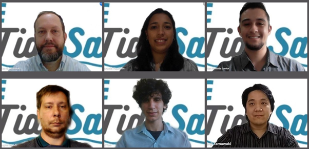
As a university spin-off, we had a great head-start on product development. The core sensor (GNSS-Reflectometer) was well validated in field experiments spanning several years at multiple locations. Data processing is the most crucial step in our workflow, whose development was only possible due to our team’s intellectual capital. We are a group of five postgraduate and undergraduate students, advised by a faculty member. Our research team has published widely on GNSS and remote sensing.
AZO interviews Douglas Leipelt (DL), public relations officer at TideSat Global (previously Satellite Tide Gauge).
AZO: Can you explain the three main ingredients of your recipe for success?
DL: Teamwork – our tightly knit team collaborates smoothly, as if in a relay race. Each member contributes their time and knowledge to support and complement the other members’ skills. Our motto is: “talent wins games, but teamwork and intelligence wins championships” (M. Jordan).
Perseverance – our team comes from a university research lab. We had to upgrade our academic mindset for entrepreneurship. It demanded much learning and engagement, especially during the pandemic.
Vision of a better world – we are deeply concerned about the environmental and socioeconomic impacts of climate change. We feel committed to giving back to society for the education we have received. We want to use our research experience to offer a practical way to deal with one of the more visible consequences of climate change.
AZO: What were the main reasons to participate in the 2020 edition of the Galileo Masters?
DL: Our intention by participating in the 2020 Galileo Masters competition was to test the reception for our business concept. While we have been researching this topic over the last years, we envisioned the fastest way for our innovation to reach society beyond academia would be bringing it to the market. The Galileo Masters’ aims fit nicely with our own goals and offered a great opportunity for exposure of our satellite navigation technology.
AZO: You also won access to the Galileo Incubation programme, congratulations! Please tell us how your incubation in the Center for Entrepreneurship in Informatics (CEI) can advance your solution.
DL: The incubation period has forced us to radically change focus. Because of our academic background, we tended to concentrate overly on the technical aspects. But mentors, advisors, and consultants at CEI have steered us about the importance of the business aspects. We have since worked on a minimum viable product, business model canvas, and a landing page.
We have interviewed dozens of potential customers and collected information about their needs and the limitations of current solutions. For example, some customers are still reading water levels on a wooden board, which is error prone and time consuming. On another hand, state-of-art systems such as radar-based tide gauges tend to be expensive and are difficult to install and maintain. We offer an intermediate-level solution, with cost and ease within reach to communities that are currently not served.
We have been taking full advantage of the incubation programme to advance our business model, by exploring which market segment would be a better fit for our solution. We are also making some improvements in hardware and software to deliver a more user-friendly service. The incubation ecosystem has offered us all-around support to mature the startup.
AZO: Let’s reach for the stars – what is going to happen in TideSat’s future?
DL: Currently, water level sensors are not as common and as numerous as they should be worldwide. There are immense opportunities for the modernization of tide gauging networks and to fill in the existing observational gaps. Our sensor can be installed under conditions that are not feasible for traditional water level recorders. So, it is expected to open new market scales that were simply out of reach for conventional technologies. The advantages of our solution grant it the potential to revolutionize the monitoring of water levels. We believe that its lower total cost of ownership will enable a massive popularization and densification of tide gauging networks. It will help countless communities around the world and will contribute to global efforts to adapt to and mitigate climate changes by bringing tide gauging where it was not possible before. In the very near future, we hope to turn existing beta testers into early adopters and actual paying customers. We envision providing our solution to government organizations, private entities, and NGO in coastal and riverine regions.
AZO: How has the pandemic affected your startup?
DL: We have been working remotely for almost one year and half now. In-person activities are still suspended, as COVID-19 remains at very high levels in the country. Recently, all our collaborators had access to vaccines. We are hopeful to resume face to face activities in the coming months.
Did you enjoy this interview with the outstanding startup? Anyone interested can get into contact with TideSat via info@tidesatglobal.com. Stay tuned for upcoming interviews with Galileo Masters startups on our AZO Blog.
About the interviewee:
Douglas B. Leipelt is co-founder and public relations officer at TideSat. He earned an undergraduate degree in Mathematics from URCAMP University in 2010. He is currently completing a second degree in Geomatics Engineering at the Federal University of Rio Grande do Sul.


Comments are closed.