The new Copernicus Masters partner Airbus is a global leader in aeronautics, space and related services. This article brings their space related activities into the spotlight and provides insight into how you can take part in these cutting-edge activities with your own idea.
Developers, innovators and Earth observation enthusiasts looking to build their solutions together with Airbus data can now do so through the Copernicus Masters. The Airbus Multi-Data Challenge offers participants the chance to take home a EUR 100,000 satellite data voucher for the Airbus GeoStore. Imagine what you could do with that!
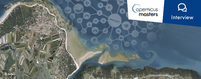
Read more about the Airbus mission, their Multi-Data Challenge in the Copernicus Masters, and why participants should not miss out on submitting their idea. Martin Pentier (MP) of Airbus, is interviewed by Florentyna Smith (FS), Project Manager of the Copernicus Masters.
FS: Airbus is widely known for its range of aircraft, but you also provide commercial satellite imagery and a number of related services. Could you provide us with an overview of Airbus activities in this space?
MP: Airbus is a major contributor to space exploration and human spaceflight, as well as a leading manufacturer of Earth observation, navigation, science and telecommunications satellites. Its portfolio ranges from the ExoMars rover and the European Service Module for the Orion spacecraft to the Ariane 5 launcher, to be followed in 2020 by the Ariane 6.
The Intelligence Programme Line of Airbus Defence and Space is recognised as a world leader in geospatial data provision and defence intelligence. Based upon proprietary commercial access to the Pléiades, SPOT, DMC, TripleSat, KazEOSat, TerraSAR-X and TanDEM-X optical and radar satellites, combined with comprehensive applications experience, Airbus delivers a broad portfolio of products and services spanning the entire geo-information value chain.
With more than 30 years’ experience in data acquisition, processing, data management and hosting, Airbus delivers sustainable solutions across a comprehensive range of markets, addressing defence & security, commercial and civil institutional customers.
Among some key products and services, we can mention Farmstar, a precision farming service operated in France for more than 16 years. Farmstar provides recommendations every year to over 15,000 farmers in order to help them reduce their environmental footprint while still increasing their yield. We can also talk about Starling service, which enables companies to demonstrate how they are implementing their ‘No Deforestation’ commitments. We also provide monitoring services in other domains, as maritime surveillance or civil engineering, to name just a few.
FS: So, there are quite a number of Airbus satellites currently in orbit! Can you choose one constellation and tell us a bit more about it?
MP: Indeed, we currently have 8 optical and 3 radar satellites in operation, plus two third party satellites. These allow our customers to access the most comprehensive constellation, leveraging from the combination of both radar and optical satellites and the complementarity of various resolutions, ranging from 40m to 0.25m.
Our SPOT constellation, made of two absolutely identical sensors phased at 180° in the same orbit are designed to cover wide areas in record time. This makes it possible to regularly update national map series free from the constraints imposed by seasonal conditions. Indeed, the constellation covers up to 6 million km² every day, which is an area larger than the entire European Union. Four weather forecasts per day are automatically integrated into the tasking process, allowing optimal efficiency, and as a result, 60% of images acquired have less than 10% cloud cover.
SPOT offers the perfect trade-off between coverage and resolution, making it quite unique in the market.
FS: Participants of the Airbus Multi-Data Challenge have access to numerous Airbus datasets on the OneAtlas Sandbox Platform. What does the platform offer developers?
MP: The OneAtlas Sandbox can be seen as the entry door to leveraging Airbus and third party Earth Observation data for new value-added services. After a simple registration, any user can access various satellite-based datasets via download, streaming or API. Depending on their needs, they will find the images they need to test and create proof of concepts and validate them with real data over various regions around the World. For example, they have access to 40 Pléiades images (50cm resolution) over the Toulouse area in France, or the entire Californian state covered by SPOT images (1.5m resolution).
We even think about data scientists who are ready to develop deep learning algorithms and provide thousands of small images dedicated to recognising aircraft, ships or cars on satellite imagery. To make it simple, you integrate our data in your prototypes. Then if you want, you can share the results with us, so we can start discussing the next steps for maturing your solution: new datasets, partnerships, access to OneAtlas platform, business or technical support,…
FS: How does Airbus satellite imagery bring added value to developers who are currently developing with Copernicus data exclusively?
MP: We really believe in the complementarity of data, whether it comes from satellites or not. If developers are already using Sentinel data for their business, it would be very easy for them to use Airbus data, SAR or optical, to enhance their services. This is both thanks to better resolution of course, and also to more qualified data for artificial intelligence, as mentioned before.
Mixing data from other sources such as UAVs, IoT, weather or any other geo-based input is key for future innovative services, and Airbus facilitates access to its data to make all this easier. This is true for elaborating proofs of concept, but also for more mature products thanks to the OneAtlas services platform to come.
FS: What makes the Copernicus Masters unique for participants and for you as a partner?
MP: Sentinel data provides unbeatable coverage and revisit capability, for free! Data is there, updated all day long. You just need the good idea to generate value from it. From an Airbus point of view, Sentinel data is key as a complement to High Resolution capabilities, for example by providing a first detection of changes on a broader scale, which could then be assessed with more focus thanks to commercial data like ours. You need to have access to best in class imagery of the specific areas in order to accurately detect what and where changes have occurred, and above all, to be able to establish what they correspond to.
FS: There are a number of other ways that Airbus is supporting innovators to turn their ideas into reality as well. What additional possibilities are out there?
MP: It is important for us to be at the very beginning of these future success stories. Therefore, we support various Open Innovation initiatives all around the world like hackathons or challenges by offering teams coaching and rewarding the best ones.
For example, we mention ActInSpace which will have its 3rd edition in May or the Airbus GEO Challenge that we launched last year. Amongst the dozens of events we’re a part of, the Copernicus Masters is really a key one we’re proud to support again this year.
During these events, we provide free data via our Sandbox to help participants evaluate the feasibility of their ideas. If the idea is successful, we invite them to join our OneAtlas Playground, where they can test the potential result of their services on a specific area in real conditions, directly on our Cloud platform.
This second collaborative step is supported by technical and business experts and is paving the way to partnerships that deliver new value-added services. In the end, it’s always a case-by-case discussion with each actor to really assess the needs and mutual interests of using our data and digital services.
FS: What does your ideal Earth observation application look like and what can it do?
MP: The simplest way to answer would be “all of those generating value”, but more than that, the best Earth Observation applications are those that solve issues much cheaper or easier or quicker than with other means. We can also think about services where the end-user is not even aware that satellite imagery was needed to deliver the solution. Of course, we’re always proud to see our data visible in end-products, but most of the time, the information extracted from the data is much more valuable than the data itself. I would therefore answer, the best EO application is the one answering your needs better than any other means.
Boost your innovative Earth observation idea with free access to numerous datasets via the OneAtlas Sandbox Platform and sign up for the Airbus Multi-Data Challenge of the Copernicus Masters 2018!


