Did you know that the Copernicus Rapid Mapping service can provide maps within three hours of a catastrophe? This blog post puts the spotlight on how Europe’s Earth observation (EO) programme Copernicus enables early response to natural disasters and helps to overcome humanitarian crises with valuable information from space. Moreover, it takes you on a journey of pathbreaking EO applications and their use for public authorities, organisations and dedicated people involved in emergency management.
Tracking Emergency Situations from Space
Every year, natural and man-made disasters cause humanitarian crises, leading to thousands of people fleeing their homes and ending up in refugee camps, makeshift shelters, or even living out in the open. Vulnerable regions and their populations are being further pressured by climate change, which is causing more severe and more frequent extreme weather.
The Copernicus programme provides precious information to enable monitoring and mapping of natural catastrophes, such as wildfires, floods and landslides. In addition, a variety of services utilise the opportunities provided by Sentinel satellite data to develop forecasting models and support prediction of such events. In disaster mitigation, a well-planned response is vital to assuring the safety, health, and security of citizens and minimising the economic consequences. The Copernicus satellite-based services thus provide timely and accurate geo data to support governments, agencies, and aid workers in managing post-disaster coordination. In addition to offering information for monitoring, mapping and managing disasters, the Copernicus programme is the basis for a number of services that make forecasting possible.
Copernicus Emergency Management Service (EMS)
The Copernicus EMS is the distinct service of Europe’s highly diverse Earth observation (EO) programme for support in response to emergency and natural disaster situations. Actors mainly involve Civil Protection Authorities and Humanitarian Aid Agencies such as the European Civil Protection and Humanitarian Aid Operations and the International Federation of Red Cross and Red Crescent Societies (IFRC). These actors involved in the management of natural, man-made emergency situations and humanitarian crises with the most up-to-date and decisive geo-spatial information derived from satellite remote sensing. The service’s components include worldwide maps as well as early warning and forecasting systems. In addition, this data is complemented by dedicated in situ and open data sources.
Winning EO Applications Help to Fight Fires and Floods
Within the international innovation competition Copernicus Masters, emergency management is annually one of the main fields of application, highlighting its potential for the creation of derived products.
The winner of the Copernicus Masters Best Service Challenge 2014, FireHub, is a service platform that consolidates a real-time fire detection and monitoring application. It offers a spatial resolution of 500 metres, large-scale burn scar mapping during and after wildfires, and a smoke-dispersion forecasting tool by integrating space technologies (including Copernicus data) with geospatial information as well as meteorological data. The platform’s target users comprise fire brigades, forestry services, civil protection authorities, emergency teams, rehabilitation organisations, insurance companies, societies, and the private sector.
The winner of the Copernicus Masters Smart Cities and Intelligent Transport Challenge by the Satellite Applications Catapult 2015, eXude system by Astrosat, provides an advanced flood-monitoring tool. It makes use of the latest SAR and radar altimetry data-processing techniques for flood identification and mapping, including in urban areas. To provide added information to the eventual product layer, high-resolution optical data from Sentinel-2 can also be used to identify and classify key features of critical infrastructure to assist in providing a useful added-knowledge service. As it evolves, Copernicus data facilitates a high level of service by providing reliable data of different types, assimilate them, to better comprehend flood situations.
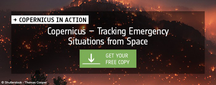
Besides these two prime examples, there are much more successful and pioneering applications to discover. The best thing is: all of them are featured in the digital version of the Copernicus in Action publication.
Explore Copernicus in Action
Copernicus in Action is the first ESA hardcover book on EO specifically dedicated to Copernicus idea competitions and Space App Camps, in partnership with AZO. Discover the myriad EO applications and how the serve economic and societal purposes in everyday life.
Get your free copy of “Copernicus in Action”.
Register now to witness this year’s most brilliant Copernicus Masters business cases in real life at www.eusw2017.eu/ and don’t miss out on Europe’s biggest space event.
We look forward to seeing you in Tallinn!
About the European Space Week
The European Space Week brings together the most important space stakeholders, companies, partners and visionaries in Europe pushing the topic of space in Europe and beyond. It is organised by the European Commission (EC) under the auspices of the Estonian Presidency of the Council of the EU and co-organised by the European Space Agency (ESA), AZO Anwendungszentrum GmbH Oberpfaffenhofen and Garage48.
Copernicus Masters and Space App Camps
The Copernicus Masters is the leading innovation platform for commercial Earth observation applications. Since 2011, it is annually awarding prizes to outstanding solutions of business and society. Since 2012, the Space App Camps regularly bring programmers together to develop creative apps that make Earth observation data – in particular from the Copernicus programme – available to a wide range of citizens. These intense events enable new user groups to benefit from the countless opportunities EO data offer in connection with mobile applications.
AZO
AZO is organising both initiatives on behalf of ESA. By leveraging its extensive experience in building and maintaining global innovation networks and organising related contests, AZO drives product innovations and the creation of new companies all along the value chain, particularly in the field of commercial aerospace applications.


