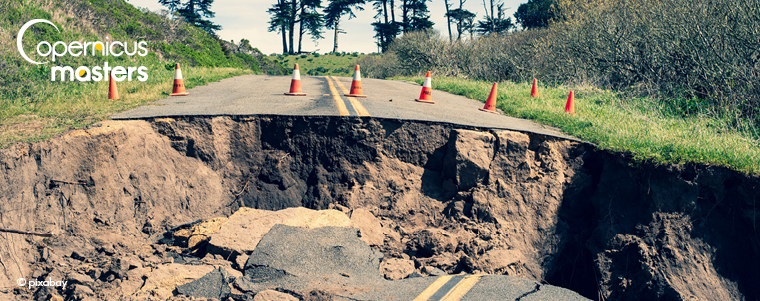
Many buildings and infrastructure assets in the world are affected by damage which is not inspected or monitored under prevention schemes. Structural damage is caused by different triggers such as ageing, deformation of construction parts, overloading of structural components, uneven settlement, landslides, and floods, among others. Landslides alone cause an average economic loss of approximately EUR 4.7 billion per year in Europe. Devastating accidents tend to occur mostly in populated cities and towns, where dense living conditions result in high personal damage as well as immense economic losses. A main issue is the slow responsiveness of management authorities in case of emergencies. This impacts on the number of resources lost. Improving the speed and efficiency of responding to emergencies could reduce the damage for citizens and the economy.
Monitoring a city’s strategic assets is vital for the safety of its citizens. Rigorous inspection and maintenance are necessary to obtain the safety of such structures. However, these interventions are both costly and time consuming, usually making it impossible to survey every single structure including those with an exceeded lifetime, which often represent higher safety risks.
Surveying the ground stability and operational security of infrastructure assets is crucial, since deformation processes hold potential hazards within or around these structures. By applying satellite radar interferometry (InSAR) technology, the operating costs of monitoring structures may be reduced by several million euros while enabling more detailed and frequent surveillance, thus resulting in better safety conditions.
Winner of the 2019 Copernicus Masters Airbus-sobloo Multi-data Challenge
Many end-users worldwide have difficulties in interpreting InSAR data and fundamentally extracting useful information from deformation maps. RemotIO solves this with its Copernicus Masters award-winning and scientifically backed solution for monitoring tasks, which offers the following features:
- Continuous infrastructure stability monitoring
- Automatic updates of deformation maps
- Near-real-time delivery of InSAR products
- Easy access to results via web-based platform
- Data mining for easier interpretation, on-time situational awareness and risk evaluation
RemotIO stands for “Retrieval of Motions and Potential Deformation Threats”. Each new satellite acquisition helps customers to improve their situational awareness during evolving deformation processes like building collapses, highway/railway disruptions or dam failures.
The system uses satellite radar interferometry in order to provide displacement measurements with millimetre precision over entire cities, urban areas and man-made structures with frequent revisit periods (days to hours) and backdating capability.
InSAR Data for Structural Health Monitoring
Satellite radar interferometry is nowadays a well-established technique for providing accuracy within a 2 millimetre range when monitoring displacement. The biggest benefit of InSAR, the independence of manual operation or special equipment present in the area of interest, enables the monitoring of nearly any site in the world.
Commonly, experts visually analyse InSAR point clouds of millions of radar targets as well as deformation maps in order to search for problematic zones in intervening areas. However, this is not sufficient for providing reliable information of the probability of movement or useful insights into the actual nature of undergoing processes. In contrast, RemotIO utilises data mining tools in order to improve the clarity of InSAR products and obtain actionable insights – also for non-expert users – while exploiting the full potential of Sentinel-1, TerraSAR-X or other SAR satellite missions.
Data Mining Capabilities
Our data mining approach allows for filtering the resultant deformation maps and pinpoints problematic zones with potential ground deformation threats. This also covers areas which might be prone to fast deformation processes, seasonal changes or other effects, whereas these areas might remain undetected by the limited rules of standard processing procedures.
The vision of remotIO is to provide easy-to-interpret outputs intended also for non-expert users by improving and automating some of the routine procedures involved in professional InSAR expertise. This may be a key step towards the widespread usage of InSAR data. It’s the most important part of remotIO’s mission to provide added-value products as well as geodetic-level InSAR expertise.
About Matus Bakon and Insar.sk Ltd:

Matus Bakon is the CEO of Insar.sk Lt. The company is a provider of InSAR measurements from the full range of satellite SAR sensors and terrestrial tools (active/passive artificial corner reflectors) with extensive experience in other monitoring techniques (levelling, GNSS, inclinometry, LIDAR, gravimetry, etc.), which the team commonly integrates and cross-validates with InSAR measurements.
Note: The development of remotIO system was done under ESA PECS Contract. Responsibility for the contents resides in the author or organization that prepared it. The project was funded by the Government of Slovakia through an ESA Contract No. 4000123625/18/NL/SC under the PECS (Plan for European Cooperating States). The view expressed herein can in no way be taken to reflect the official opinion of the European Space Agency.


Comments are closed.