Multi-scale approaches to remote sensing offer an invaluable stream of data. Different temporal, spatial and spectral resolutions are readily available, and one of the big challenges for those using Earth Observation (EO) data is really how to utilise the full range of those datasets. The existence of data from multiple sources and resolutions (ground based, aerial, satellite) gives companies and institutions the possibility to monitor their assets with the aid of this multi-sourced data.
Businesses and institutions usually look to use EO data because they want to improve and increase the information flow, allowing them to better manage their activities. However, they are faced with the same challenge: how to ingest, analyse and utilize all that massive amount of information. The fact that there is not a complete business integration of the many resolution scales of EO, poses a large barrier for EO solutions to become valuable to businesses and institutions.
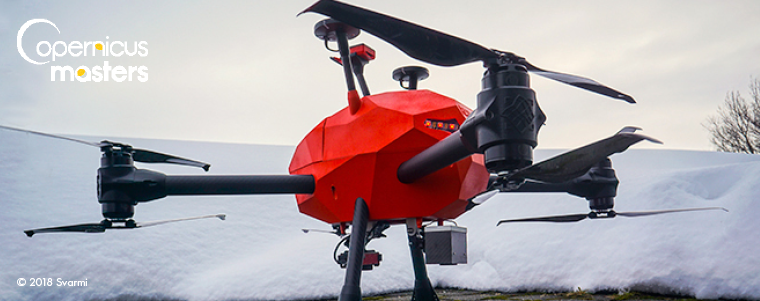
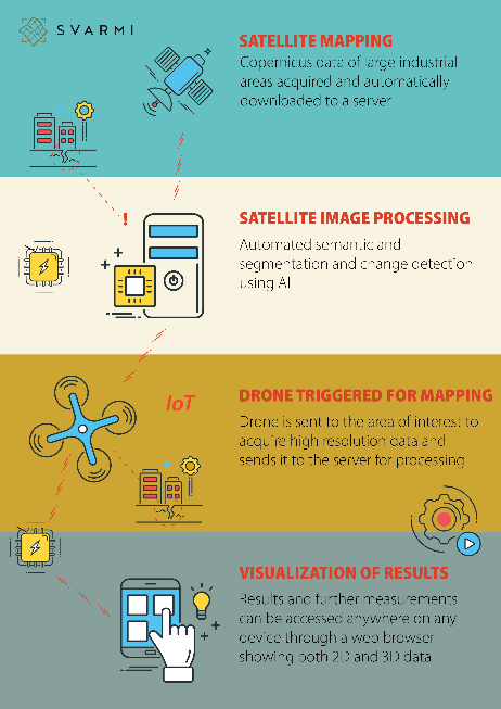 Our project Myriad aims to facilitate EO monitoring of industrial areas through a combination of multi-source remote sensing, IoT and Artificial Intelligence (AI). Myriad is an Internet-of-Things (IoT) system that triggers autonomous UAV surveys based on the changes detected using Copernicus imagery. The project makes use of the constant stream of Copernicus data (Sentinels 1-3 and Sentinel-6) to perform automated change detection over selected assets. The objective is to perform a selective change detection with continuously updated Copernicus data, that triggers UAS surveys when changes are detected, having all the datasets served through a web browser. Those surveys will be done with the Svarmi UAV platform that autonomously plans, flies and delivers data. Thus, the customer will set one or more Myriad bases in their area of interest, and when changes are triggered by Copernicus data, the drone will automatically survey the area.
The change detection takes place on a convolutional neural network (CNN) that is trained with a variety of datasets that are related to industrial scenarios. Detected anomalies are directly sent to an automated UAV developed by Svarmi with the help of the Icelandic Technology Development Fund. The automated UAV automatically plans a flight over the detected anomaly and surveys it. The collected dataset is re-ingested into the system to be further used as a ground truth over the detected anomalies. The user input is crucial here and is part of the multi-resolution approach. The user receives the update over a web application and can identify if the change detected is meaningful or not, thus improving the quality of future detections. In this sense, reinforcement learning capabilities are crucial to keep updating the detection models and delivering meaningful emergency alerts to customers.
Our value is to support the requirements of large-scale monitoring, by providing an integrated solution with Copernicus, UAVs and user input datasets. The problem is that the time span between Copernicus data acquisition, analysis and UAV surveys can be very lengthy. Thus, through a fully automated monitoring programme, we intend to reduce the time between receiving input data and outputting actionable information, offering our customers a powerful tool for cost effective monitoring.
The legal aspects of our solution matter a lot to us, and this is why our solution is mainly targeted over controlled areas or industrial areas such as energy, mining, forestry or agriculture, where automated planned flights could be performed without disrupting the public space. Currently we have customers in the energy sector in Iceland which are already interested in our solution.
Our fully integrated and autonomous monitoring service is recognised by ESA, having won the ESA EO Future Challenge of the Copernicus Masters 2019, awarded in Marseille. In the words of Dr. Thomas Beer, Copernicus Policy Coordinator at ESA “In the event of sudden environmental disasters, providing fast, reliable information to rescue teams is key. This is even more important in areas accommodating major industrial sites, such as nuclear or chemical facilities. The MYRIAD drone system working on Copernicus Sentinel imagery and triggering rescue activities automatically upon change detection will reduce the time elapsed from the occurrence of the event until the initiation of countermeasures by an important margin. MYRIAD combines perfectly the potential of Copernicus Sentinel-1 and -2 observations with the rapid close-up observation capacity of drones”.
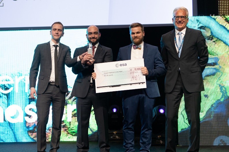 Our participation in the Copernicus Masters has been a great experience for the whole team at Svarmi. Back at our offices, we usually dream big and test many new ideas both in the field and in the lab, but we never thought that one of our ideas was going to be recognized by ESA and the space community! Being at the Awards Ceremony in Marseille was a big boost for our morale, and it was great to share and network with many other great ideas and businesses. Winning the ESA EO Future challenge has certainly brought a lot of attention to our company, as we are the first ones to receive such prize in Iceland.
We received a lot of coverage in the media, and many clients were quite happy to be collaborating with a company that dreams big and achieves great things! Also, having our business model backed up through recognition from ESA has been a great help when convincing our investors that our ideas are worth it! In terms of the monetary prize, it has been amazing to further advance the detection algorithm and to collaborate with Sobloo (DIAS) to automate our services in their cloud. Again, we never thought that we were even going to pass the first selection, but here we are! For all of you out there that have a crazy but somewhat possible idea, do not doubt for a second to apply for the next Copernicus Masters 2019, it could very well be a new start for you, as it has been for us.
About Victor Pajuelo Madrigal:
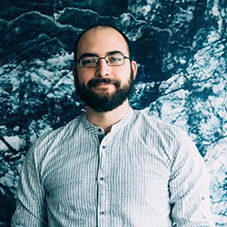 Originally from Spain, Victor moved to Iceland back in 2010. He studied Philosophy in his Bachelor, but was always interested in programming, science and environmental issues. That made him study a MSc. in Environment and Natural Resources at the University of Iceland, with a specialization in Geography and Remote Sensing. During his studies, he taught himself machine learning, advanced programming, remote sensing and GIS web development. It was during his studies that he helped Svarmi, together with the whole team, to become the Icelandic leader in remote sensing and machine learning applied to UAV and satellite datasets. Since then, Victor has been fully focused on developing Earth Observation products with both merging traditional remote sensing methodologies and deep learning approaches.
