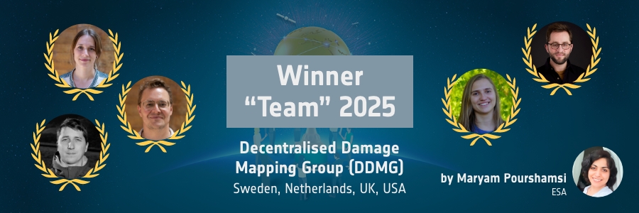
The Decentralised Damage Mapping Group (DDMG) has received the prestigious EO Excellence Award for their innovative use of satellite data to track damage in conflict- and disaster-affected regions. By combining radar and optical imagery from satellites like Sentinel-1 and Sentinel-2, DDMG can monitor urban destruction, agricultural losses, and damaged infrastructure, even in areas that are hard to access. Their work helps improve humanitarian response and supports informed decision-making for rebuilding and protecting communities.
In this interview with ESA’s Maryam Pourshamsi (MP), the DDMG team (DDMG) talks about their journey to the EO Excellence Award, the unique challenges of using satellite data in conflict zones, and how their research is making a real-world impact. They also share how the award will help them expand collaborations, organise workshops, and advance their mission to bring timely, reliable information to those who need it most.
MP: Can you provide an overview of the innovative project that earned you the EO Excellence award?
DDMG: We are an international collaborative initiative focused on leveraging Earth Observation (EO) datasets to develop innovative solutions for damage assessment in conflict and disaster-affected regions. We aim to advance scientific excellence in monitoring the environmental impacts of armed conflict, foster international collaboration across disciplines and communities, support transparency and reproducibility of conflict impact analysis using EO data, and engage with diverse user groups and stakeholders.
We established DDMG to address the lack of timely data on damage to cities, agricultural land, hazardous facilities, water sources and forests caused by war, especially in protracted or under-reported conflicts. Having timely data on the locations, timing, and severity of damage is of utmost importance for improving humanitarian response and the protection of civilians, which is a moral and legal imperative.
DDMG assessments rely on a wide range of EO data products. We have used Sentinel-1 radar interferometry within a coherent change detection approach to document the geographic extent and trends of urban damage across all human settlements in Ukraine, the Gaza Strip, Northern Israel, and Lebanon. Similarly, we have used Sentinel-2 time series to map agricultural damage across the Gaza Strip and Lebanon. In addition to that, we also use optical high-resolution images to map, for example, solid waste in Yemen, oil pollution in Syria, and water infrastructure in Palestine. The media uptake of this work has been unprecedented with over 550 citations of DDMG research in journalist outlets across 16 countries to date.
MP: What motivated you to participate in the EO Excellence Award as a nominee?
DDMG: We are actively seeking funding opportunities that align with the expertise of our team. The EO Excellence Award criteria matched our profile well, and we saw it as an opportunity both to highlight our work within the EO community and to secure support for further development. In addition, the award provides a valuable platform to raise the visibility of this topic with ESA and its broader community, leveraging ESA’s influence to amplify impact.
MP: Can you describe your journey through the EO Excellence Award process and how it impacted you both personally and professionally?
DDMG: We discovered about the nomination quite late, so we only had a few days to organise and submit a nomination. A major challenge was to decide who of us in the larger group should be mentioned in the nomination, as everyone in our group is actively contributing to the work we do. Winning the award was a very nice way for DDMG to get recognition for the hard work we have done in the past few years and to raise awareness among a broader audience on the use of remote sensing for conflict monitoring. The award has really encouraged us to continue and the recognition is especially important for the early career researchers in the group.
MP: How have the resources and recognition from the EO Excellence Award contributed – or how do you expect them to contribute – to the advancement of your professional goals?
DDMG: We are only at the start of the EO Excellence award journey, but we believe receiving this prestigious award will be extremely useful for our careers, both as individuals and as a team. We hope this recognition will make it easier to gain funding, promotions, and positions as it distinguishes us within the field of EO. The award grant is very welcome as it will help us organise two workshops where we can discuss and decide what direction DDMG should take in the future, expand our network, and develop plans for long term sustainability. The discussions can further promote the utility of EO in conflict monitoring and contribute to saving lives and protecting the environment people depend on.
MP: What unique challenges arise when using satellite data for damage mapping in conflict zones, and how does DDMG address them?
DDMG: There are so many unique challenges in conflict settings. Beyond the obvious challenge of constraints to physical access due to security concerns, we usually settle for pseudo-weekly imagery when we would prefer to have pseudo-daily imagery across an entire conflict setting to better ensure that we are tracking the damage as frequently as possible over the course of a conflict. It’s increasingly common to see restrictions on access to very-high resolution commercial imagery, so we rely mostly on moderate resolution imagery, which has a variety of mixed pixel effects that challenge identification of specific kinds of conditions and changes, especially in spatially dynamic landscapes.
More broadly, it’s difficult to know what detected changes are associated with the conflict, especially changes that might be indirectly caused by the conflict and so take place farther away from conflict hotspots or far after a conflict. We can’t satisfactorily address any of these but we mitigate them by using multiple EO and geospatial datasets, cross-referencing our data and findings with other complementary studies, open-source investigation and understanding conflict processes and patterns rather than just discrete events.
In addition to the technical limitations, there are also ethical challenges, regarding the potential impact of our work, the context in which information is shared, and the extent to which these efforts truly serve the most vulnerable populations.
MP: How does DDMG ensure the accuracy and reliability of its data, especially in hard-to-access or contested areas?
DDMG: Since we rarely have access to the field to collect actual ground truth data, measuring ‘accuracy’ against a validation dataset is difficult. Instead, we conduct a series of agreement exercises with datasets produced by other groups – these could be damage locations or gross estimates of change – and interrogate reasons for disagreement and agreement. We build counterfactual and long-term comparison studies that give us a clearer picture of what typical changes as well as unexpected, anomalous changes look like in the satellite record. DDMG members have widespread experience using EO data to map environmental changes in several different contexts, inside and outside of conflict settings, and we draw from this breadth of expertise. Finally, we seek out local-level insights from journalists and humanitarian actors and local civil society partners as well as open-source intelligence sources for local-level insights that guide qualitative assessments of our remote assessments. Even with all of the above, we can never resolve all errors so we do our best to clarify the agreement and known limitations to end-users as best we can.
MP: How do your analyses influence concrete humanitarian actions or policy decisions?
DDMG: Understanding the impacts of conflict on communities is critical to prioritise and direct aid delivery and rebuilding efforts. However, conflict settings are often rife with disagreement amongst conflict groups and sometimes external actors. Methodologically transparent EO assessments have the potential to establish a shared understanding around the locations, timing, and severity of damage in hard-to-reach areas. Coordination around open methodologies are useful not only for humanitarian decision-making around specific aid interventions during an armed conflict but also for post-conflict peacebuilding, which relies in part on establishing a shared understanding of conflict impacts. We have supported many international humanitarian organisations with our analyses, which we distribute at no cost thanks in large part to the open access nature of data from the ESA data ecosystem. The findings are also influencing policy discussions on conflict impacts in various UN forums, including the UN Security Council, the Human Rights Council and the UN Environment Assembly through specific resolution and policy debates.
MP: What future developments or technologies could further enhance or expand DDMG’s work?
DDMG: Technological developments offer an opportunity to enhance the understanding of conflict impacts on the environment. For example, we are very excited to see how we could leverage new radar systems such as NISAR and new hyperspectral systems. By increasing the visibility of environmental challenges, we hope for more informed and effective decision-making. There are also promising developments on the use of artificial intelligence and no- or low-code platforms that broadens the access to EO data for a larger community of interested people. But technological improvements alone are not effective unless the information is meaningfully interpreted; making sense of the data requires the involvement of affected actors. Therefore, deeper collaborations with conflict-affected actors and co-production of damage assessments presents the greatest potential for improvement. This is one of our main goals in using the generous support of the EO Excellence Award, where in the second workshop we will invite organisations working in and with conflict-affected communities.
MP: Many thanks to the DDMG team for this inspiring conversation. Their recognition with the EO Excellence Award highlights the importance of collaborative Earth Observation research in addressing global challenges and supporting communities where it is most needed.
If you know someone who also deserves to win the EO Excellence Award, nominate now eoxcellence.com!
About the Author
Maryam Pourshamsi is an Earth Observation Scientist at European Space Agency. She is responsible for managing the EO Excellence Award. The award recognises and honours an individual early career scientist and team that have made an outstanding contribution to the innovative use of Earth Observations in the field of science and applications.


