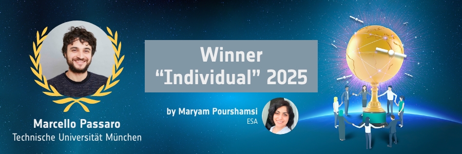
Marcello Passaro has been awarded the prestigious EO Excellence Award for his outstanding contributions to satellite altimetry. Through the development of innovative algorithms, he has made it possible to use satellite data on sea level and wave height in coastal regions, areas that were previously considered too difficult to measure. His work not only opens new perspectives for climate research and oceanography but also provides valuable foundations for coastal protection and the study of sea-level rise.
In this interview with ESA’s Maryam Pourshamsi (MP), Marcello Passaro (MPa) shares insights into his long-standing connection with ESA, the challenges and opportunities of competing for the EO Excellence Award, and the real-world applications of his research. He also offers a forward-looking perspective on how new satellite technologies and methods such as machine learning could shape the future of coastal altimetry.
MP: Can you provide an overview of the innovative project that earned you the EO Excellence Award?
MPa: I received this award in recognition of my contributions to satellite oceanography. Specifically, I have been developing algorithms to process radar signals in order to better estimate sea level and wave height in regions where such data were previously considered unusable. While I did not solve all the challenges in this field alone, I succeeded in creating a solution that can be adapted to a wide range of satellite missions. Most importantly, I was able to validate my method, apply it extensively to generate new datasets, and contribute to answering key scientific questions. For example, how much has sea level risen in coastal zones during the Earth Observation era, and how do wave heights change as they approach the shore?
MP: What motivated you to participate in the EO Excellence Award as Nominee?
MPa: ESA has been part of my journey as a scientist since my school days, when I used to subscribe to the ESA Bulletin and receive it by post. During my PhD, I had the privilege of spending an incredible year as an ESA trainee, and many of my fondest memories, both scientific and personal, are connected to ESA events. Although I had to give up a potential future at ESA to stay close to my family, I have always felt a strong connection to the agency and a desire for recognition from it. When I learned about the EO Excellence Award, I asked my colleagues whether they thought I might be a suitable candidate. Fortunately, they gave me the encouragement I needed to participate.
MP: Can you describe your journey through the EO Excellence Award process and how it impacted you both personally and professionally?
MPa: I actually participated in the EO Excellence Award already in 2024 and was thrilled to hear that I had been selected as a finalist. At the time, I thought, ‘Nice, that was it.’ But the following year, after a conversation with one of my former mentors, I was encouraged to try again. I was honoured to receive support from more than one colleague as potential nominators, so I decided to go for it. Although I believed I was a strong candidate, I was genuinely surprised to receive the final prize. I assumed people might think, ‘This one already tried!’ I was very excited when I got the news, especially for the reasons I mentioned earlier. Still, I quickly returned to everyday life. That same evening, at the dinner table, the main topic was my son’s first visit to his future elementary school!
MP: How do you expect that the resources and recognition from the EO Excellence Award will contribute to the advancement of your research and professional goals?
MPa: This award is an excellent opportunity to pursue initiatives that I usually do not have the chance to realise. For example, I work at DGFI, a research center for Geodesy that is part of the Technical University of Munich. It is a beautiful place to be, but international students in their early twenties do not immediately associate it with sea level, waves, and oceanography. Additionally, Munich and TUM (Technical University of Munich) are major hubs for remote sensing, which means there is strong competition to attract students. I would like to use part of the resources to fund full stays for students from ESA member countries, allowing them to come to Munich and work with me on their Master’s theses. This would help raise awareness of our research and foster new collaborations.
MP: What are the main challenges in applying satellite altimetry to coastal zones and how does your research address them?
MPa: In coastal zones, changes in sea level and wave height occur much more rapidly than in the open ocean. This, combined with the presence of land, makes it more difficult to use the radar signals that satellite altimeters send and receive. Yet, the coastal zone is the part of the ocean that matters most to us, as it is where our homes and infrastructure are located. My research addresses these challenges by developing algorithms that improve the detection of sea level and wave height near the coast, while maintaining the performance typically achieved in the open ocean. I then integrate my results with other processing stages, including work done by colleagues in the community, to produce new datasets. These datasets give access to observations that were previously unavailable, allowing me to identify open scientific questions and explore whether they can be answered thanks to this increased data availability.
MP: How has the Adaptive Leading Edge Subwaveform (ALES) algorithm improved the accuracy and usability of coastal altimetry data compared to previous methods?
MPa: Over the past 15 years, many promising algorithms have been developed to improve coastal altimetry data. What made ALES stand out was its adaptability to any radar altimeter in orbit since the 1990s, and the fact that users could rely on it even in the open ocean, with consistent performance. The core idea behind ALES is to focus the analysis on the part of the received signal that is free from interference, such as that caused by nearby land. By doing this in a smart way, we could preserve the quality of the data without compromising the standards.
However, I believe the real success of ALES comes from persistence. I didn’t stop at proposing an algorithm. I made it work, collaborated with colleagues to produce full datasets based on ALES, and used those datasets to conduct scientific research. This helped convince the community that the time had come to start analysing coastal sea level and wave height using satellite data.
MP: What are the most significant real-world applications of your research, particularly in climate science, oceanography, or coastal engineering?
MPa: I was genuinely astonished by the range of applications that my research has enabled, from observing sea level in narrow creeks between sea ice blocks to studying how coral reefs help protect coastlines by reducing incoming wave energy. This goes far beyond what I had imagined at the beginning of this journey.
If I had to highlight two significant real-world applications, I would first mention my contribution to assessing sea level rise at the coast. This means that modellers and decision-makers can now rely on satellite data to verify how well predictions have matched reality over the past three decades, precisely in the areas where infrastructure is located, rather than relying only on global or large-scale averages.
Secondly, my work has made it possible to measure how the average height of waves changes from the open ocean to the coast at a local scale. This can support research into how wave energy could be harnessed for renewable energy production, among other applications.
MP: How do you see the future of coastal altimetry evolving, and what role will machine learning and new satellite technologies play in this field?
MPa: Coastal altimetry is evolving rapidly, and we are approaching a point where the data quality will match that of open ocean altimetry, at least for future observations. However, we cannot go back in time and use modern satellite technologies to retrieve past data. What we can do is use machine learning, along with present and future observations, to better understand how the coastal ocean changes. This knowledge can then be applied to fill observational gaps in the past, helping us avoid waiting another 30 years to build time series long enough for reliable climate analysis.
Another key challenge is ensuring that observations continue to expand in the coming decades. We now have advanced technologies that allow us to obtain something like a ‘local snapshot’ of sea level, rather than just a one-dimensional line of points along the satellite track. For example, the CNES-NASA SWOT mission offers this capability, but it revisits the same location only every 10 to 20 days. This is not frequent enough to reliably observe extreme events, which are still difficult to model and predict. In this context, ESA’s commitment to the Sentinel-3 New Generation Topography mission is a major step forward and gives hope for more consistent and timely observations in the future.
MP: Thank you Marcello, for sharing your insights and experiences. The EO Excellence Award not only honors your achievements, but also underlines how Earth Observation research can inspire innovation and deliver valuable knowledge for both science and society.
If you know someone who also deserves to win the EO Excellence Award, nominate now eoxcellence.com!
About the Author
Maryam Pourshamsi is an Earth Observation Scientist at European Space Agency. She is responsible for managing the EO Excellence Award. The award recognises and honours an individual early career scientist and team that have made an outstanding contribution to the innovative use of Earth Observations in the field of science and applications.




Comments are closed.